Fáilte Ireland will borrow the Google Trekker to add some of Ireland's tourism areas that are located off the beaten track to Street View.
The wearable backpack system is mounted with a spherical device containing 12 cameras that gather images as it goes, similar to the Google Street View cars that can be seen on the roads.
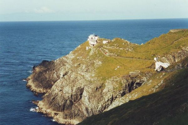
The Trekker, however, will allow Fáilte Ireland to capture images from remote tourism sites such as Mizen Head (pictured), Inishbofin, Achill, the Blaskets and Craogh Patrick.
The tourism board is borrowing the device from Google, which allows the Trekker to be loaned by tourism boards and other non-profits, to extend its global mapping system.
Fáilte Ireland has the Trekker for three months and begin shooting this week covering areas around the Wild Atlantic Way tourism trail, to be followed by other remote areas along the coastline and hot spots on Ireland's Ancient East.
The use of Google Street View for tourism planning is becoming increasingly prevalent. "Three quarters of visitors told us that they use the internet to plan their itinerary here before arriving" said Daragh Anglim, Fáilte Ireland’s Head of Digital.
"We hope that these images inspire many viewers to subsequently make the crucial decision to come over here to see the real thing."
